Highlight Pyramidenkogel
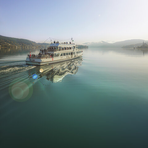
With the ship to the Pyramidenkogel! The hike to the Pyramidenkogel is certainly one of the highlights of hiking by boat on Lake Wörthersee. The standard hiking routes run from Dellach, Maria Wörth or Reifnitz on the well described hiking trails up to the lookout tower and back.
However, we give you here our very special insider tip:
It is best to take the circular hiking trail from Reifnitz to Maria Wörth. For this easy hike you need about 2 hours for the ascent and 1 hour for the descent. With a leisurely rest and a visit to the lookout tower, you should allow a total of 5 hours, or half a day.
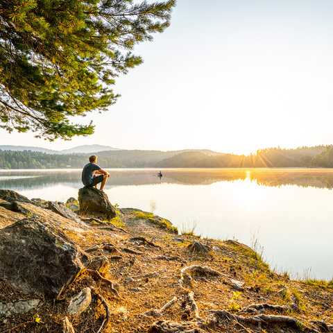
From Reifnitz, you first walk through the Reifnitz Moor with the nature trail, and then slowly climb up to St. Margarethen to the old church. Here you should definitely take a break and enjoy the view of Lake Wörthersee.
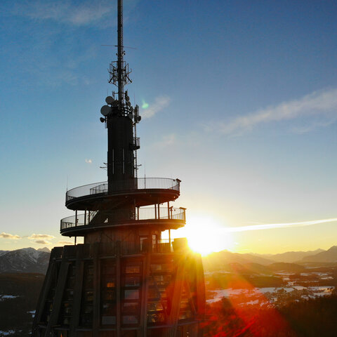
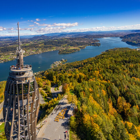
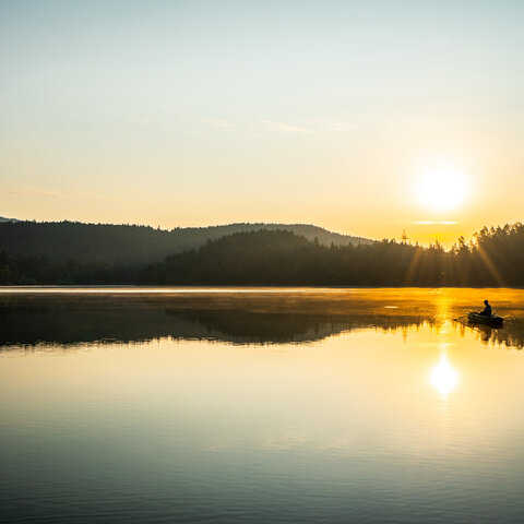
From here, the trail climbs steeply to the top of the Pyramidenkogel. Here awaits as a reward one of the most beautiful viewpoints in all of Carinthia: the lookout tower!
It is the highest wooden lookout tower in the world and offers you on the one hand an incomparable view over the entire Wörthersee. On nice days, you can also look far into the Carinthian countryside. The unforgettable panorama stretches from the Saualpe in the east to the Hohe Tauern in the west, and from the Karawanken and Julian Alps in the south to the Gurktaler Alps and Nockberge in the north! But don't forget to take the Wörthersee Plus Card with you, because with it you also get a 20% discount on the entrance fee!
After the visit to the lookout tower, it's back down to Lake Wörthersee. Be sure to take the variant back to Maria Wörth. Because then you can visit another Wörthersee highlight quasi "in passing": the peninsula of the same name with the two churches!
By boat to the Slow Trail Römerschlucht and further to the Forstsee.
A beautiful, easy hike: Take the boat from one of the numerous landing stages on Lake Wörthersee to Velden. From there it is a 30 minute walk to the starting point of the "Römerschlucht - Hike". The start of the actual hike begins exactly where you would probably not expect it, namely right above the Lifestyle Hot Spot Velden. This trail is a plea for slowness and invites you to mindful hiking. Once you get around the first bend of the trail, you are immersed in the silence of the forest and can concentrate entirely on yourself, your rhythm while walking and your breathing.
The popular end points or turning points are on the one hand the viewpoint at the "Hoher Kreuz" and on the other hand the Forstsee. For this hike it is best to plan about 2 hours from Velden for the hike to the "Hoher Kreuz" or 4 hours if you also want to walk around the Forstsee.
From the Velden boat landing stage to the Kathreinkogel mountain
From the landing stage in Velden you walk in the direction of Schiefling. From there, the Kathreinkogel circuit begins. You walk through the Schiefling forest to the foot of the Kathreinkogel. Along the information boards about the history of settlement from the Neolithic Age to Roman times, the path then winds its way to the top of the Kathreinkogel, where the small church, the House of Archaeology and the widely known wishing tree await the hikers as a worthwhile destination.
Tip for the whole family: Prepare your own personal wish at home. Write it on a small wooden board. The wooden board should have a small hole so that you can thread a suitable string through it and when you arrive at the wishing tree, attach it to the tree. The wind will carry your heart's desire out into the world and thus make it come true! Afterwards, pause on the bench at the adjacent lookout point, enjoy the view and take a lot of strength from this wonderful place.
Should be planned from Dellach about 5 hours or half a day for this beautiful hike to the Kathreinkogel.
Attention: for this hike you have to follow two different signposts! First from Velden to Schiefling the signage "Zur Kathreinkogel-Runde" and only here you are then on the signposted route "Kathreinkogel Runde"!
Hiking with the ship - from Krumpendorf to the Pirkerkogel.
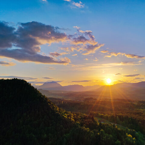
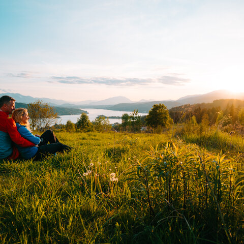
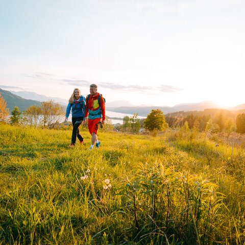
From the boat landing you walk along the Pamperlallee. There the path passes by the Parkbad and leads through the small village along the calming waterway in the direction of Pirk. The trail continues to the highest point of this path - the Pirkerkogel. This leisurely hiking trail is very popular due to its moderate ascent. In addition, you are rewarded by breathtaking views over Lake Wörthersee. Especially worthwhile is the ascent at sunset!
Tip: this loop is also ideal for all trail runners! Since it is part of the Wörthersee circular hiking trail, it can also be extended as far as you like!
Second tip: How about a quick cool down after the hike in the Wörthersee? The trail leads past the Parkbad again. This is the municipal pool in Krumpendorf, which has little attractions ready for the whole family!
Plan at best about 3 hours for the round hike to the Pirkerkogel.